Available On Demand!
Imagine a world where near-real time satellite data acts as an early warning system, monitoring climate change indicators before they escalate, and where resource management is optimized through precise mapping, ensuring the efficient use of land, water, and energy. For the first time in history, we possess the remarkable ability to rapidly and accurately process immense amounts of satellite imagery, enabling us to detect subtle changes, map evolving trends and quantify differences on Earth’s surface with unprecedented precision. This raises the question: what is the art of the possible when we harness cutting-edge geospatial systems to enhance national security, improve environmental monitoring, and optimize resource management?
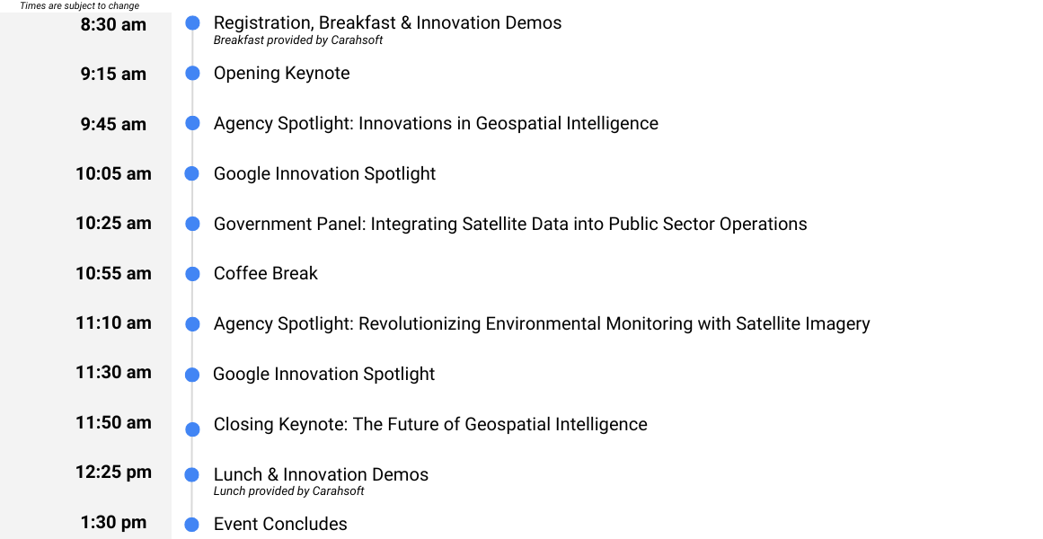
Join us as public sector leaders gather to discuss integrating satellite data into government operations for near-real time monitoring and intelligence gathering. Discover how these advanced technologies can tackle some of the most pressing challenges faced by governments today. From safeguarding natural resources to addressing climate change, the possibilities are vast and can transform how we understand and interact with our world.